Product Description
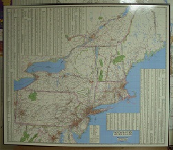
This laminated map of the Northeast US covers from the northernmost tip of Maine, south to Washington DC, and west to the western edge of Pennsylvania. States included are: Maine, New Hampshire, Vermont, Massachusetts, Rhode Island, Connecticut, New York, Pennsylvania, New Jersey, Maryland, and Delaware. This map features major cities and highways for the entire area as well as state and county lines and major park/recreation areas. Indexed for city locations. A great business tool for any company. JIMAPCO, 1989, 50″x44″.


Reviews
There are no reviews yet.